Photo Credit: Mark Pearson
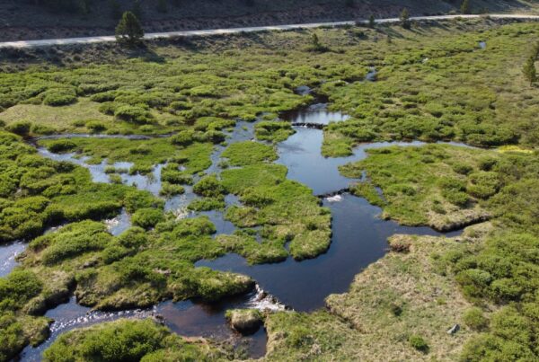
The entire Dolores River Canyon below McPhee Reservoir is a special place to be sure. Anyone that has had the opportunity to explore the corridor via boat, foot, horseback, bike or vehicle, knows this to be true. As the river flows from south to north, it traverses through a diverse landscape ranging from the ancient Ponderosa parks in the Ponderosa Gorge to the more expansive terrain through Slick Rock and Big Gypsum Valley.
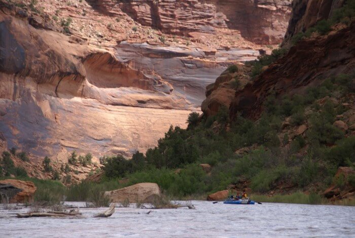
I’d like to highlight one area in particular that stands out as a shining star of the Dolores River corridor. Just past Big Gypsum Valley, the river drops into the Dolores River Canyon Wilderness Study Area (WSA). Now this is a really special place. This area is sometimes referred to as Slick Rock Canyon due to the sheer and deep cut canyon walls standing tall as the river meanders past cultural sites, big horn sheep, and stunning side canyons that call to passers by for an adventure. The red Wingate Sandstone is the predominant formation, but twelve geological formations spanning 160 million years of geologic history are exposed by the river in the gorge. The cliffs rise to benches of bedrock 500 to 700 feet above the river, with the canyon rim 1,100 feet above the river. Tributary canyons include La Sal Creek, Coyote Wash, Spring Canyon, Bull Canyon, and Wild Steer Canyon, all delightful canyons with sculpted slickrock and plunge pools.
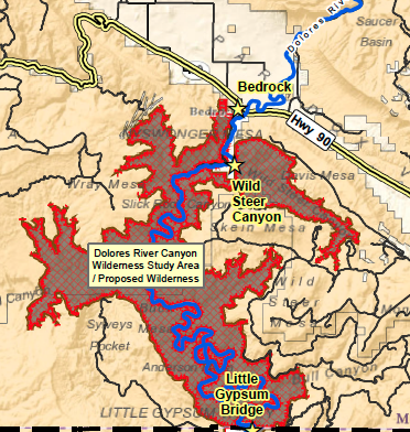
Created in 1980 by the Bureau of Land Management, the WSA spans the Dolores River Canyon and adjacent side canyons from the north end of Big Gypsum Valley downstream (north) to the town of Bedrock. The Dolores River Canyon WSA is a pristine desert area containing some of the most outstanding canyon scenery in Colorado. It provides an unparalleled experience for hiking, boating, and horseback riding. Unlike some WSAs in Colorado, this area has been recommended by the BLM for designation as Wilderness by Congress.
Wilderness Study Areas were never meant to be a permanent designation. They were designed to be a management placeholder that would maintain wilderness characteristics until Congress took action and either designated them as Wilderness or released them back to the status of general BLM land. In many cases Congress hasn’t taken action so they have remained in this temporary category for years.
We hope to see the Dolores River Canyon WSA become designated Wilderness as part of the National Conservation Area being proposed by the Lower Dolores River Working Group for the river corridor spanning from just below McPhee Dam to the town of Bedrock. It is a collaboration geared towards respecting and protecting water rights and agricultural uses of the water while also protecting key conservation values within the river corridor. Designating the WSA as Wilderness has long been a priority for the Alliance and it has become an important part of the overall solution for the Lower Dolores that is being crafted by local stakeholders. We will share more about the process as it unfolds and keep you posted about when you can engage to support this collaborative proposal that is envisioned to be a real win-win solution for the diversity of stakeholders and communities engaged in the process.
Read our previous blog: Let the Dolores Process Unfold