It wasn’t the several contiguous weeks of working from my home “office” that motivated me to journey to the HD Mountains (between Bayfield and Chimney Rock National Monument); rather it was the need to see firsthand yet another set of proposals to scar this landscape with still more natural gas wells and associated pipelines.
As I arrived to pass through the just-opened Forest Service gates to the few roads that enter the HD’s, my mind kept reaching back to the slogan emblazoned across SJCA-minted t-shirts from the late early 2000’s “Gas Wells, Need or Greed? Save the HD Mountains.” And I wondered, was this really true – was another fossil fuel onslaught of the HD’s underway again?
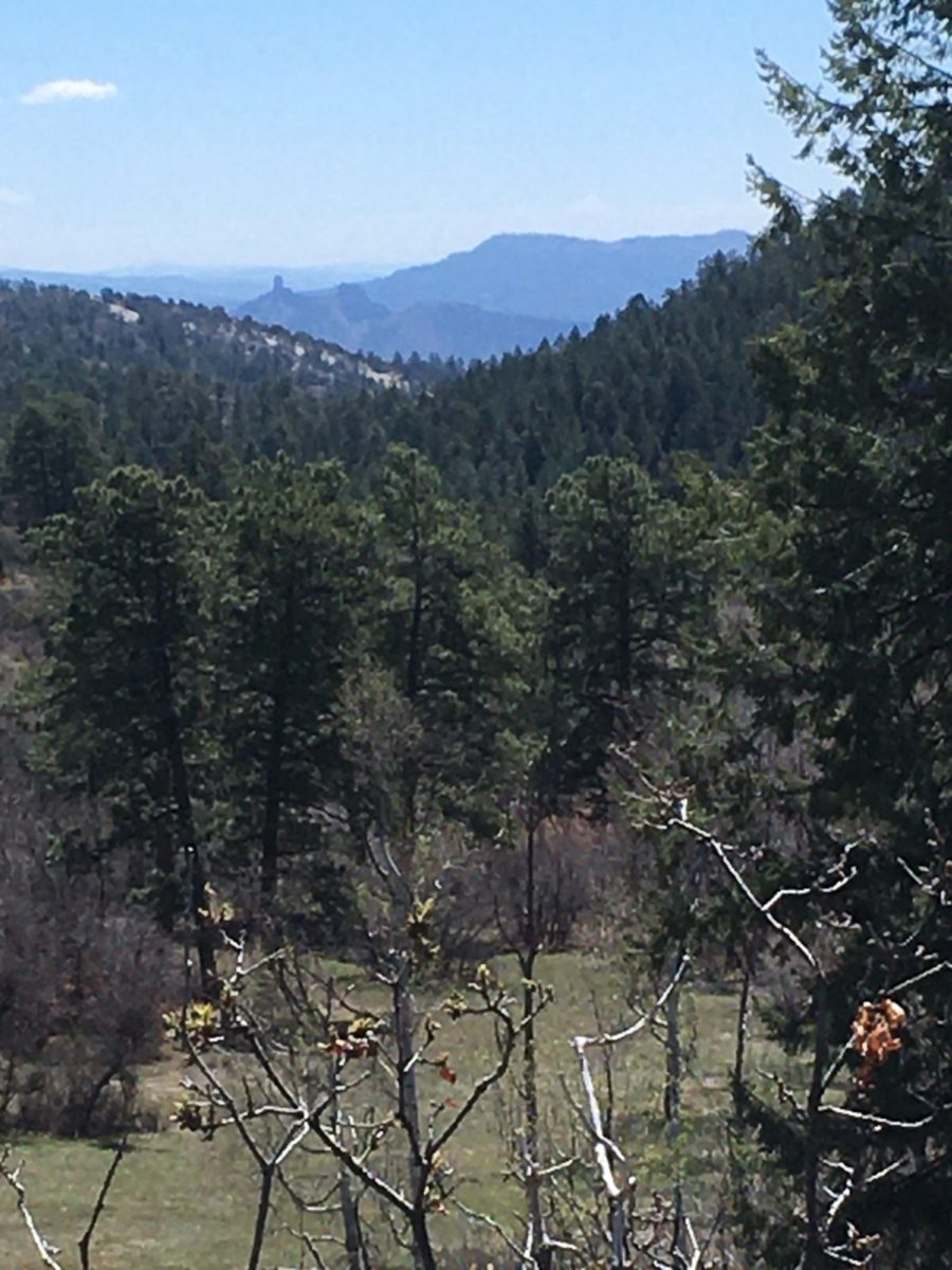
Chimney Rock National Monument as seen from the proposed pipeline corridor.
After taking in a restorative gulp of the HD’s scenery and spring-greening, I started my field day with a longtime resident and property owner living on the northern edge of the HD’s. Our walking tour was focused on the proposed route of the Northern Extension Pipeline as envisioned by Petrox Resources and detailed in a recently released draft Environmental Assessment (EA) from the San Juan National Forest. Petrox desires to drill more natural gas seeking coalbed methane wells in the Fruitland formation and connect them with a web of pipelines to carry natural gas and the waste water that is produced during the drilling and production processes.
And, just so it’s clear to the reader – this proposed pipeline web is not akin to the underground phone or cable line to your home but rather establishes a 50 foot wide permanent right-of-way and the “right” given is to disassemble and rearrange the soil, plants and living creatures within the 50 foot wide swath. And it’s intended to be 9.4 miles in length.
Indeed, as with essentially every public land related decision there are always the given reasons to proceed with extractive development – “homes are heated with natural gas”, “gas is cleaner than coal”, and of course “the company owns the mineral leases and they have the right to develop them.”
However, after almost fifteen years of conservation work with the Alliance, I have become weary of these excuses to move ahead with fossil fuel development.
As I’ve come to know, if allowed these projects most certainly will further foul the air, obliterate wildlife habitat, assault the soundscape with continuous motorized decibels, degrade the water quality, mar the viewshed, fell large conifers- the list goes on and on. In reality, there are cleaner energy courses than natural gas. And, to me (and I’m sure to others as well), there’s something out-of-balance with handing over our public lands to corporations so they can gain monetary wealth. Oh yeah, they lease the land (often inexpensively) and they pay royalties on their produced product, but in balance there’s no longer any doubt in my mind as to how the cost versus benefit calculus pencils out.
Back to the tour…we walked the proposed pipeline route for a half mile that is described in the draft EA as one of the “existing disturbance corridors including….an old road bed for approximately 4.6 miles…” Frankly the EA is wrong – the so-called “old road” can more accurately be described as a linear meadow that is less than fifteen feet wide in some cross-sections and according to my local guide hasn’t been used as a motorized transport corridor in more than fifty years. A corridor of “existing disturbance” it is certainly not, other than the disturbance created by the hoofprints and scat of native wildlife.
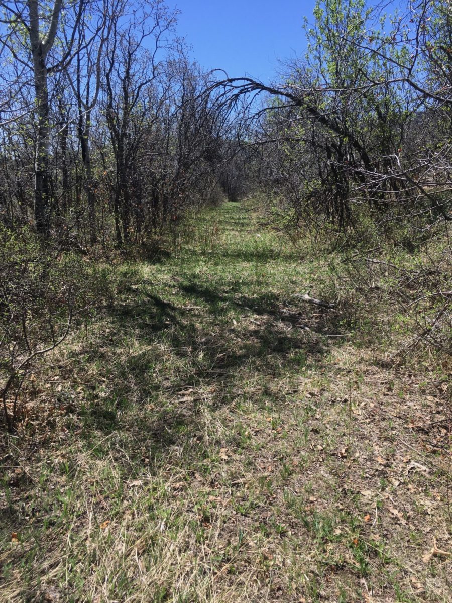
An “existing disturbance corridor”? Yes, there were elk tracks.
After some mild bush-whacking we found a set of survey stakes and flagging that marked the first of the many proposed wellsites I was to visit that day, this one located in a Colorado Roadless Area (CRA).
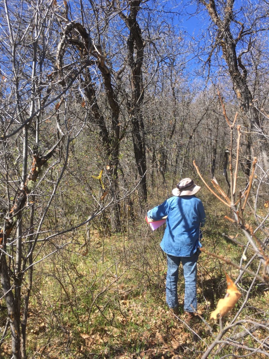
A little bushwhacking to find the proposed wellsite in the Colorado Roadless Rule’s HD Mountain Roadless Area
Yes, you read that correctly – INSIDE the 25,000 acre HD Mountain Roadless Area which the San Juan National Forest’s own forest plan describes as a “large unfragmented tract of land serves a critical role (in that it provides functioning watersheds and biological strongholds that promote diversity for plant and animal populations).”
According to my quick review of the Federal Register, the Colorado Roadless Rule was not established, nor does it give a green light to, ripping out bird-nested conifers or deer-chewed shrub habitat for the purpose of increasing the level of carbon dioxide in our atmosphere – ‘nough said.
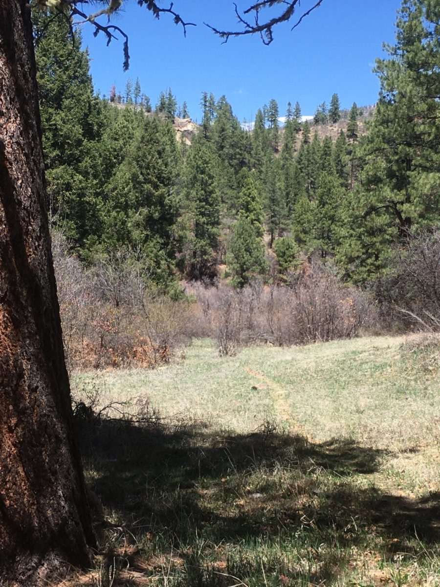
From here it was on to ascertain which of the two proposed Petrox pipeline routes further to the south might possibly inflict the least damage to the landscape and its wildlife residents. The defined choices are either defiling the verdant and meandering Little Squaw Creek or up and through the mixed meadows and forest of Pole Gulch “pass.”
Frankly, neither of them even should be under consideration, but being on a mission to match a proposed pipeline corridor with conditions on the ground I succumbed to another lovely exploratory hike.
It wasn’t too far up the gulch that a trail formed-up, not a San Juan National Forest system trail, but rather a wildlife-created trail. Judging from sign, it appeared that elk and deer were the most common travelers, but then, there was a bear scat – and a fresh deposit nonetheless. Reminding my Alaska-trained senses that these were “only” black bear, I scurried ahead, rolled over the pass and then thanks to my quiet trail travel etiquette I saw movement across a wide meadow. I “stopped and dropped” and indeed, it was another gift-on-the-day from the HD’s, a black bear sow and two cubs! Thanks to a cross-wind, they didn’t smell me nor did they see me (blind as bats those bears) and I enjoyed a 10 minute viewing opportunity as the bear family nosed about seeking foodstuffs to bulk up their spring physiques – lucky me.
But of course, it’s “lucky bears” as well – they still have the wild-enough HD’s to call their home.
The obvious follow-up question is – how long will they continue to have the HD’s as their home? Will the HD Mountains continue to be freely roamed by ursus americanus, or will the HD’s be yet another damaged landscape that was inflicted by “usus-americans-of-endless-energy-appetite”? The outcome is to date undecided, but pending – we’ll share with you soon on these pages the information as to how you can pitch in to support the sow and her cubs.
Lions and tigers (maybe not) and bears!
HD resident nosing about for spring eats.
Most often I spend my working days focused on finding solutions to public land conundrums. Finding “a way forward” as we navigate the twisting trail of the multi-use mandates of federal land management agencies isn’t for the impatient or inflexible persona and usually involves a heavy dose of communication and compromise.
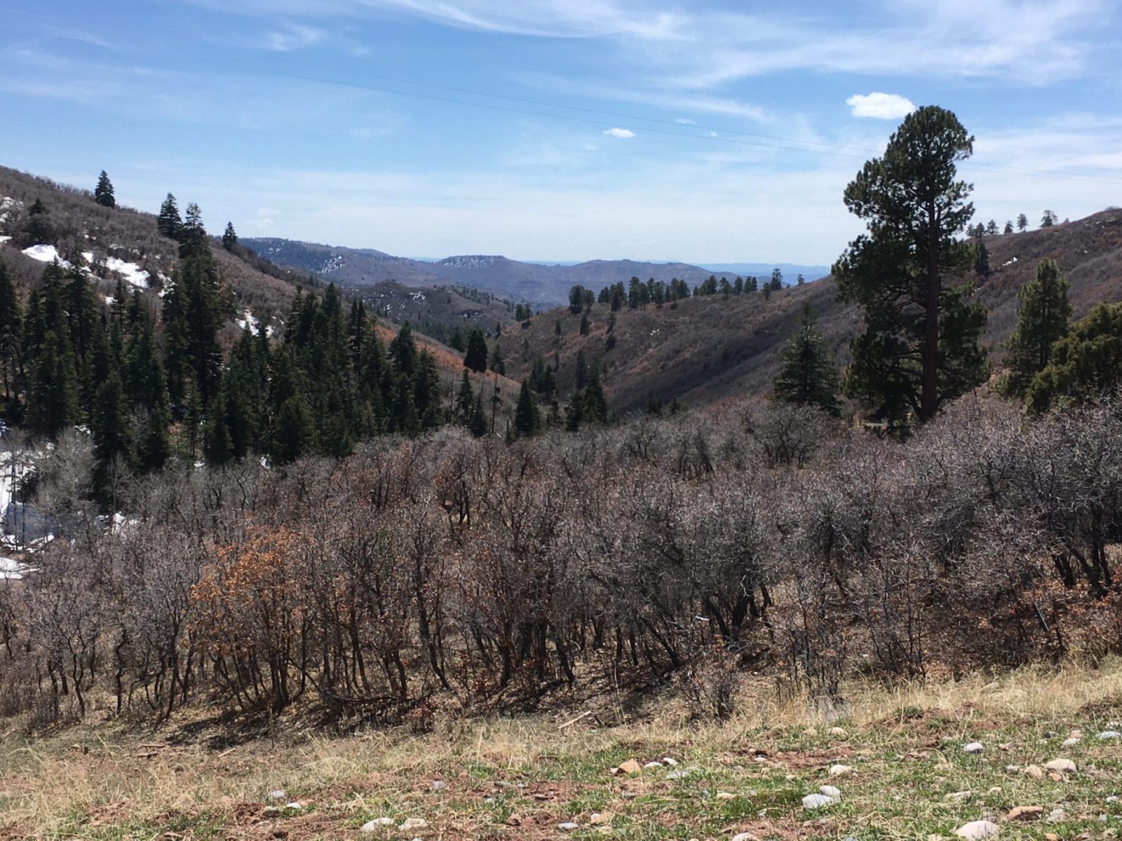
The HD’s – “just” quiet, beauty and wildlife habitat
However, after a day of diligence in examining the choices at hand (and very much enjoying my time in the HD’s enroute) I have clearly determined that no compromise is indicated for the Petrox proposal.